Posidonia oceanica is a seagrass, and it grows in meadows on the seafloor along the Cilento coast of southern Italy. A healthy meadow is a nursery for the fish the local fleet depends on, it stores carbon in a root mat that builds up over centuries, and it settles the clear water this coastline is known for. It is also invisible from the surface. Divers see it; everyone else takes it on faith, so damage from anchors, nets, and warming water accumulates with no one quite watching. The Posidonia project exists to make the meadow visible.
The model
The center of the work is a digital twin of the Cilento Posidonia meadows: a model of the meadow that stays current. It brings the existing public data sets together with modeled data, checks the model against what surveyors find in the water, and takes in live inputs over time, starting with sensors operated by people in the community.
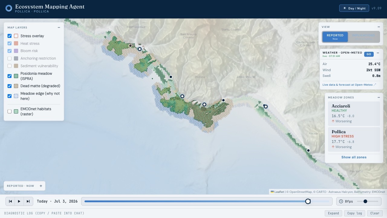
The first layer exists today. We have built a data logging system that maps onto the public data sets and compares survey data against modeled data, so a sensor reading, a diver's transect, and a satellite pass all land in the same record. That record is the foundation the twin grows on.
We are building the instruments alongside it: a GPS tracking device for work on the water, ecosystem maps that place the meadow among the reefs, sand flats, and fishing grounds it borders, and remote sensing for the stretches of coast no boat visits often.
Who it serves
A model is only useful if someone can act on it, so we are designing the application layer alongside the twin, shaped to the people who will open it. A fisherman needs to know where the meadow is before he drops anchor or sets gear. A student at the Paideia Campus needs real data to learn on. A resource manager needs a record solid enough to monitor the meadow and enforce the rules that protect it. The public needs a way to see what has been under their coastline all along.
Once the model shows the meadow as it stands, it can also run it forward. Before the town commits to a mooring field, a restoration plot, or a new protection boundary, the twin will be able to simulate the investment and show what each choice is likely to buy.
How we work
The pieces of this system live in separate worlds. The scientists who study Posidonia, the offices that regulate the coast, the people who fish it, and the companies that could build hardware for it rarely sit at the same table, and each holds something the others need. Island Lab's position in the project is to work across all four: academia and science, government, community, and industry.
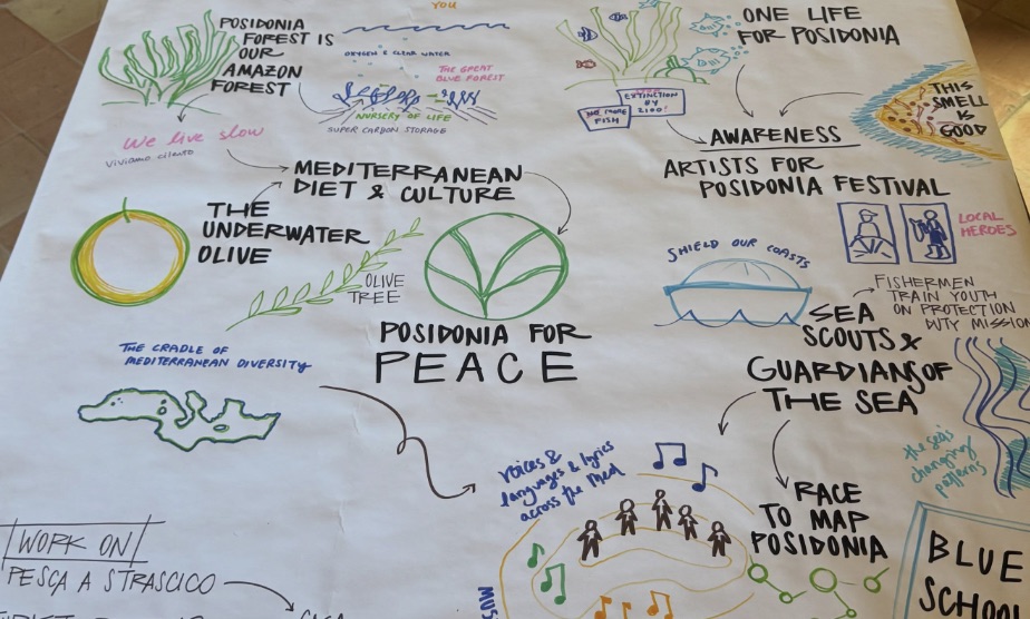
We hold the project to three tests at once. People in Pollica have to want the tools, so public engagement and demand come first. The system has to pay for its own upkeep, so a workable economic model is part of the build. And the methodology has to stand up to scientific review, or the data will convince no one.
We scale by piloting. Each stage of the system gets tested small, in real conditions, with the people who will run it, before the next stage is built on top of it, so confidence grows with the system. Skills building runs through all of it: operating the twin should be a trade learned in Pollica and kept there.
Who holds it
The tools are being built to be handed over. The aim is a set of lightweight instruments and applications that a town of a few thousand can run, and when the work is done, the twin, the sensors, the application layer, and the data itself belong to the BLUERA initiative and the Pollica community.
The record of this coastline should live on this coastline, in local hands.
The project grows out of a standing partnership with the Future Food Institute and the Paideia Campus in Pollica. How that relationship began, and why it made this work possible, is told in A week in Pollica.
If you build sensors, hold marine data sets, or work in remote sensing over coastal water, and a meadow like this is where you want your instruments to matter, we would like to hear from you.